
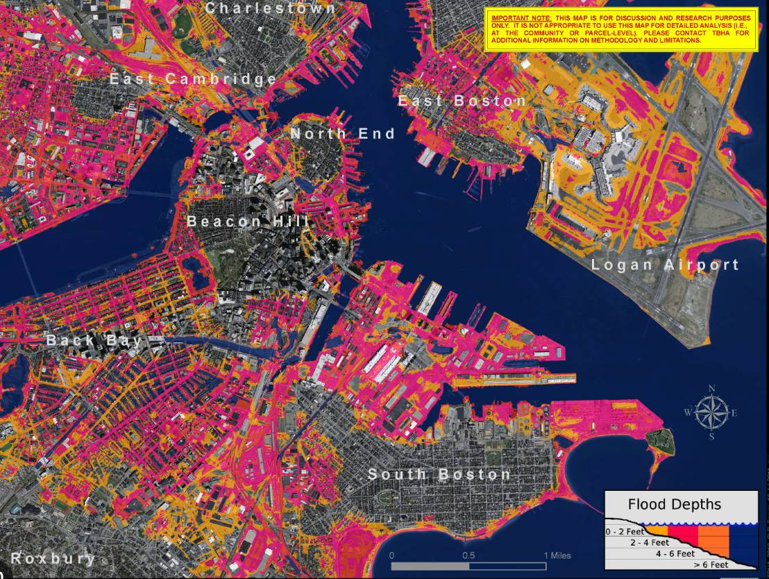
Investment in infrastructure to protect Boston from the worst ravages of climate change-related flooding is on the way. The US Army Corps is recommending 20 projects across the city—East Boston, Charlestown, Downtown, South Boston, and Dorchester—that will include infrastructure in the form of levees and floodwalls where they are most needed. The price tag: $10 billion.
According to a report by Bianca Garcia for WBUR, “The study will qualify Boston for federal funding to cover 65% of the project costs. Congress will consider funding a few projects at a time, every two years. The remaining costs will be shouldered by a mix of stakeholders, including the city, state and private partners…
Should city officials indeed sit on their hands in the face of climate change, the Army Corps predicts Boston can expect $54 billion in damages from flooding between 2040 and 2090. The city’s Office of Climate Resilience considers that figure to be ‘the floor, or a starting value.‘
Already, ‘sunny day’ flooding is happening more frequently in Boston. And with rising sea levels, frequent storm surge and stronger precipitation, the study found that 40% of city residents currently live in an area at risk of flooding before the end of the century…
The infrastructure projects they recommend would address 16 miles of vulnerable coastline, protecting assets in the ‘federal interest,‘ like transportation lines, hospital systems and postal systems….
Other ambitious projects from the study include building a flood wall around the entirety of Raymond Flynn Marine Park in South Boston. This is a key area for the city’s shipping and warehousing industries, so trucks require frequent access to the water. The study recommends a mix of park, berm and floodwall along its waterfront edge, but it specifically requests community feedback on its arrangement.”
Read the report in full.
Image: Flood Map from Boston Harbor Now