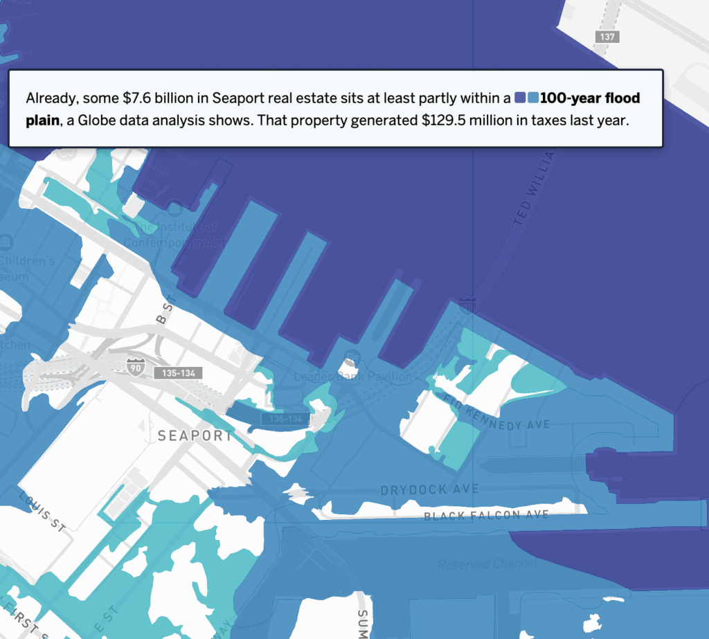
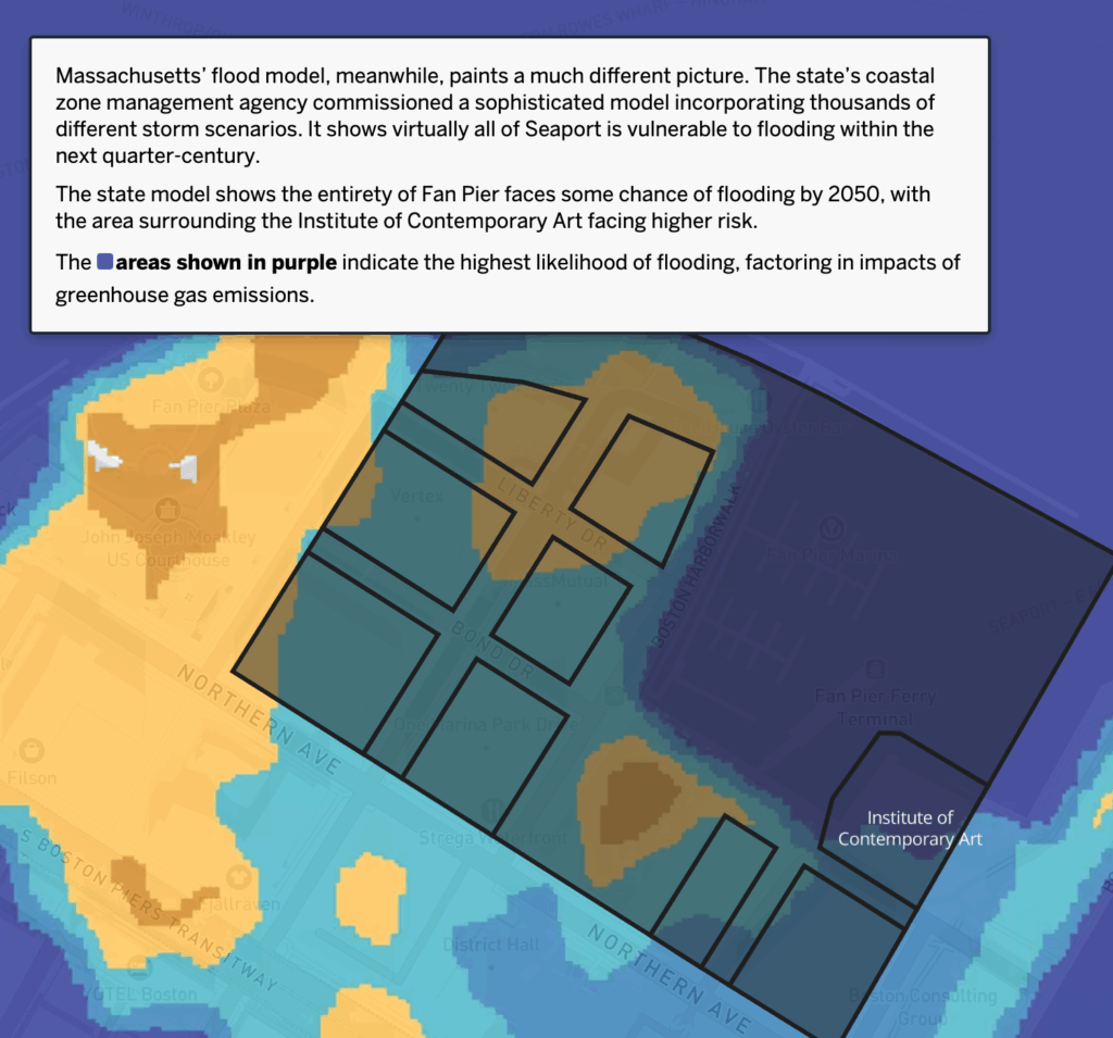
The “cash cow” that is the Boston Seaport is increasingly at risk. According to a Boston Globe report by Catherine Carlock and Yoohyun Jung, “Rising seas threaten to reclaim those old mud flats, and, together with more frequent and severe storms, could swamp the neighborhood that has risen atop them. In all, 99 percent of what’s been built in the Seaport in the last quarter-century is at risk of flooding by 2050, according to a recent analysis from the Metropolitan Area Planning Council.”
While developers claim that the high rise buildings are designed to withstand flooding, they don’t mention the impacts to the streets and tunnels that connect the Seaport to the rest of Boston. “Sea water coursing down Seaport Boulevard and storm drains spilling up onto Northern Avenue will inevitably make even the best-designed condo tower hard to reach, the swankiest restaurant unappealing. As waters keep rising, the value of those buildings could decline, and with it a tax base that pays for services all over Boston.”
The multinational engineers firm Arup estimates that one in seven Bostonians (about 100,000 people) will be exposed to flooding by 2050. In some communities—East Boston, South Boston, and the South End in particular—floods could force 9,000 people to leave their homes and seek public shelter.
The Globe report includes interactive maps of the current and expected impacts in the Seaport and across Boston.