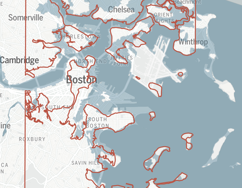
The Boston Globe published Erin Douglas’ excellent—and urgent—overview of the danger coastal cities face as climate change brings back the water. The article appears in the May 19th issue of the newspaper and highlights the impending crisis in a city that is one-sixth artificially ”constructed.” In fact, coastal neighborhoods like East Boston, Charlestown and downtown Boston face the gravest danger. As a whole, Boston is “deep into overtime” to build coastal protections, writes Douglas.
Excerpts from the article:
“‘As far as I know, Boston has more [made land] than any [city] in the United States, and I’m pretty sure more than any in North America,’” said Nancy Seasholes, a historian and historical archaeologist who wrote a history of landmaking in Boston.
That means the artificial land is both more vulnerable to sea level rise and more difficult to protect from flooding with heavy sea walls. But without those projects as climate change worsens, Boston’s map of flooding risks during severe storms could look a lot like the map of Boston’s shoreline hundreds of years ago, according to a state model that estimates future flood plains.
For two centuries starting in the late 1700s, artificial land was constructed throughout Boston on top of tidal flats with almost anything the engineers of the day could think of: mostly dirt from nearby hills, but also excavated mud, garbage, and coal ash.
High points throughout Boston were removed, including Beacon Hill. At its summit, Beacon Hill once towered 60 feet higher than today, according to one calculation. Across Boston, materials were piled up to create new land, usually behind granite sea walls, until the ground reached a few feet above high tide.
“‘They thought to fill it above the level of high tide was adequate, and it was — at the time,’” Seasholes said.
Now, however, climate change is pushing Boston’s high tide higher…
Climate scientists expect Boston could see between 2 and 4 feet of sea level rise by 2070 compared to 2000 levels, depending on global greenhouse gas emissions….
…future proofing is happening now because much of Boston’s artificial land sits directly in the likely path that flood waters would travel during an extreme storm, particularly as the sea level rises.
[But] what happens when the money dries up?”
_____
Map: 1630 shoreline by the Leventhal Map & Education Center: Flood data by MA Office of Coastal Zone Management. From The Boston Globe, 5/19/24


