
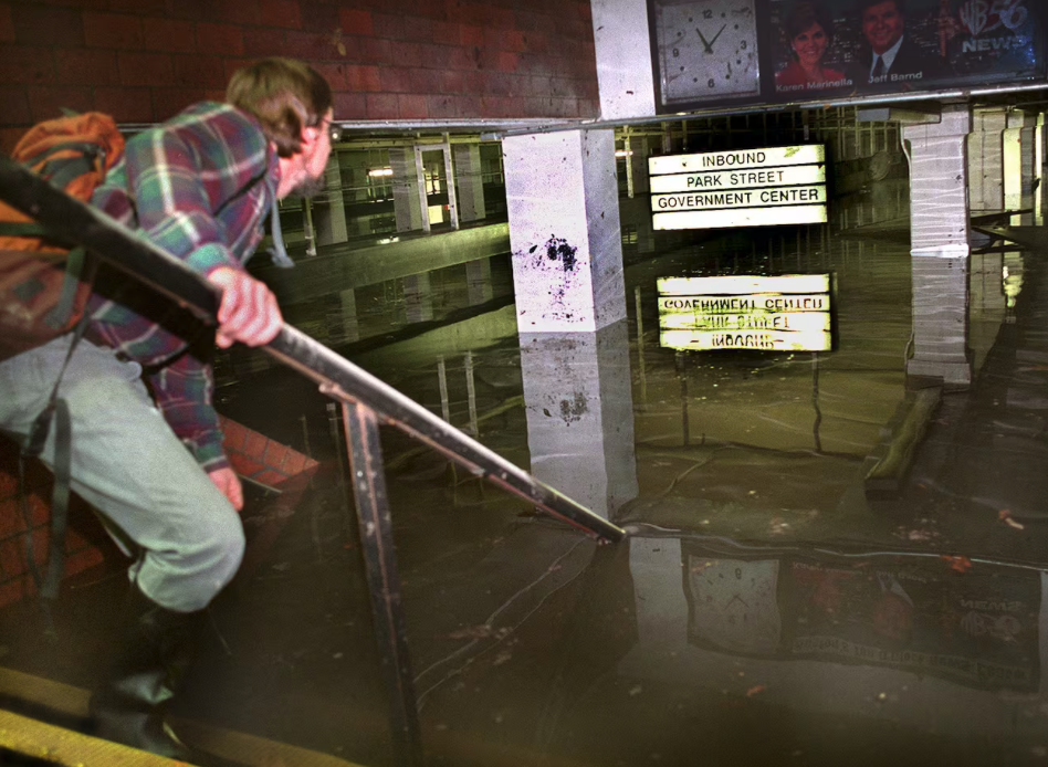
The Boston Globe commemorated the catastrophic Muddy River floods of 1996 with an article by columnist Danny McDonald on October 25, 2026. The report recalls the complex combination of factors that made the 3.5-mile urban waterway a prime location for flooding—and the disastrous impacts that led to the Muddy River Restoration Project.
McDonald writes, “Back in the mid-1990s, the Muddy River was markedly different than it is today. The 3½-mile-long waterway that meanders from Jamaica Pond to the Charles River was choking. An invasive kind of reed had obstructed it at different points. The river was also congested by decades of sediment.
One of the more visible results of the years-long restoration that changed the river may be parkland near the Landmark Center in the Fenway neighborhood…
Previously, that green space was a Sears parking lot that forced the Muddy into too small underground pipes. The flooding showed the folly of that design, and the river was “daylighted” in that part of the city as part of the restoration project, which returned the parking lot to the urban green space it once was.
The flood knocked out portions of four branches of the Massachusetts Bay Transportation Authority’s Green Line. Kenmore T Station was submerged under 10 feet of water, one of seven subway stations to be crippled by the flooding. T tunnels were closed for six days, as crews scrambled to pump water out and repair the damage.
For some advocates, it was the end-product of short-sightedness and negligence. Earlier in the 1990s, federal officials studied but rejected plans to improve flood control along the Muddy River in Boston and Brookline. Authorities said such a project would cost too much.”
The challenge for current and future stewards of the Muddy and its parklands is to muster the will and the resources for continued and vigilant stewardship.
Read the article in full.
Photo: Boston Globe archives, John Tlumacki, 1996